Ward Profiles
Mapping Stories of Bristol
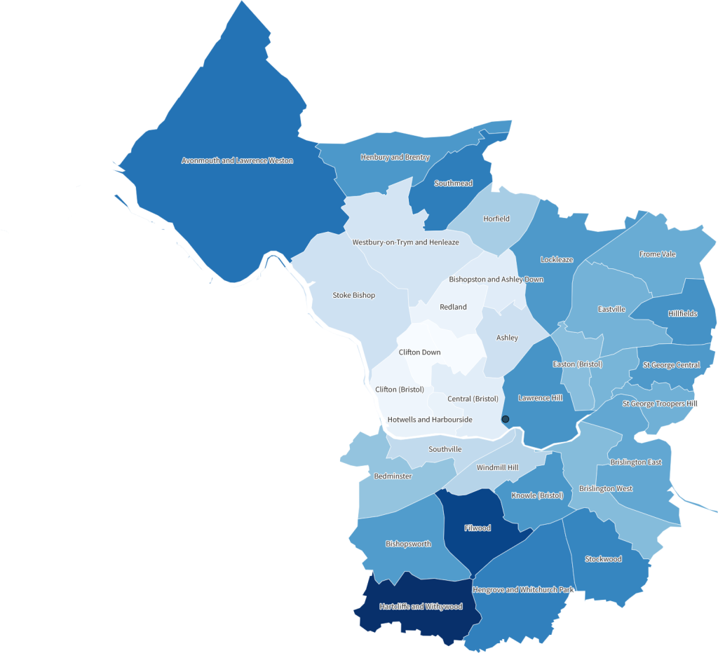
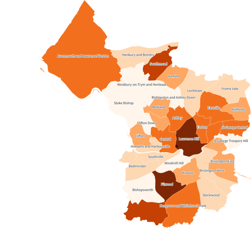
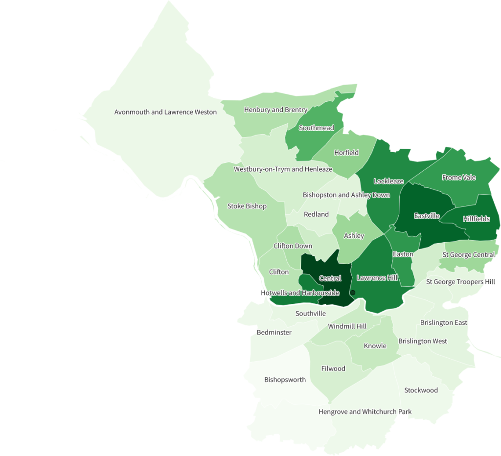
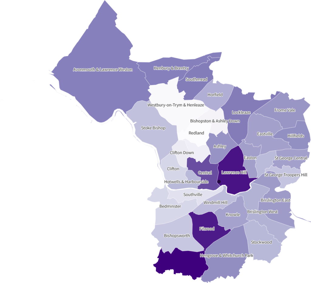
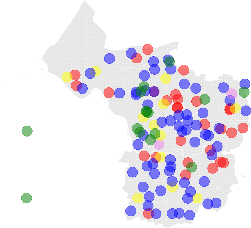
Bristol has 34 administrative wards. The Repair-Ed project will focus on 10 wards in the city.
Over the next 5 years, the Repair-Ed project will be drawing on stories from schools and their surrounding communities to map the characteristics and inequalities of these different parts of the city.
We’ll be exploring people’s experiences of their local areas and their stories of primary schooling – alongside their hopes, challenges and ideas for reparative futures of education.
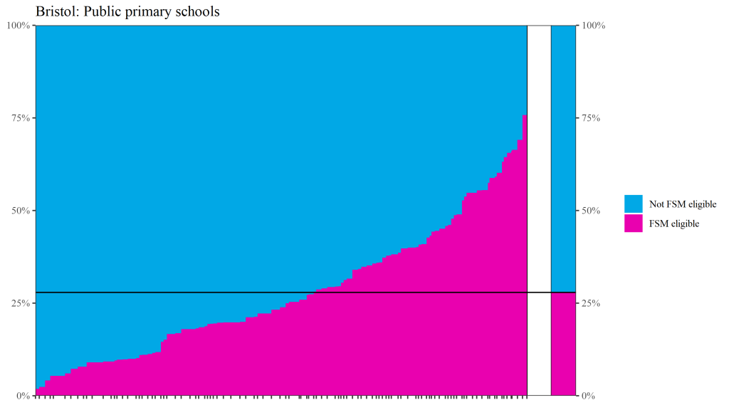
The maps below allow you to explore publicly-available quantitative data relating to schooling and young people at ward-level across the city.
These visualisations help us see the wider structures that shape everyday life and schooling across Bristol, including the structural barriers that perpetuate racialised and class-based inequalities in primary school education. However, as Gillborn et al (2018) remind us, summary quantitative data only provides a partial picture. Afterall, it does not allow us to understand the power structures and processes that create and legitimise inequality in the first place. It’s also important to recognise that it doesn’t offer us an objective reality or window on the world. The ways in which numerical data is collected and presented are always shaped by ideological and political interests.